Wisconsin Wetlands Association’s (WWA) Kyle Magyera and Stephanie Rockwood have been hard at work over the past few months supporting the South Shore Flood Resilience Assessment project, a four-year, NOAA-funded collaboration focused on addressing flood vulnerabilities across Lake Superior’s south shore.
The work began with the wonderful project team building a shared, collaborative vision for how we can help town and tribal governments reduce flood risks and damages in the region. These efforts positioned us to start community conversations to help us better understand their flooding problems and develop and deliver information to help address them.
Here are some highlights of our activities:
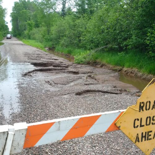
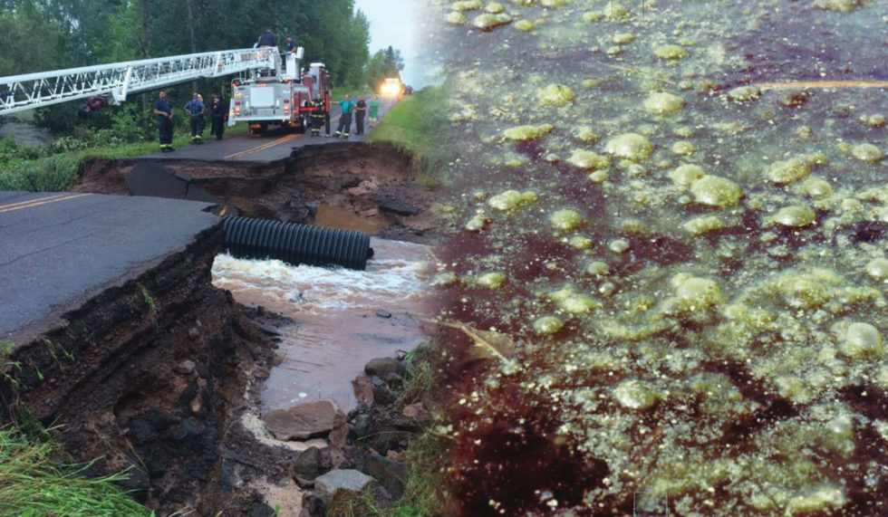
Road washouts leading to gravel loss and sedimentation in adjoining wetlands are common challenges towns face. Photo courtesy Iron County.
In July, WWA staff and partners at the Lake Superior National Estuarine Research Reserve met with highway, conservation, and emergency management departments in Iron County and Douglas County, to discuss project details and local flood-related issues in the Montreal River and Nemadji River watersheds, respectively. Culvert inventories and challenges related to erosion and aging infrastructure were common themes in both counties.
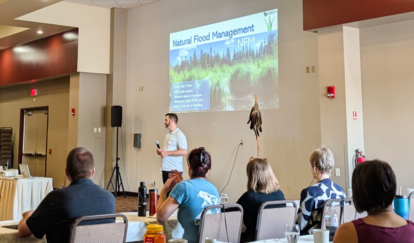
In August, WWA staff joined the Great Lakes Indian Fish and Wildlife Commission (GLIFWC) and Ojibwe representatives from across the region in a nibi (Ojibwemowin word for water) relationship plan workshop. Kyle gave an overview of our natural flood management work in the region and our goals and activities for this project. Following the presentation, small groups discussed some perspectives and experiences related to flooding, how the nibi relationship plan can inform our flood resilience assessment and engagement activities, and ideas for how we, as project leaders, can make sure tribal perspectives on nibi are incorporated into our work.
In September, staff from the Superior Rivers Watershed Association (SRWA) and the Burke Center helped WWA host meetings with both Ashland and Bayfield County highway, conservation, and emergency management departments. In addition to discussing the same topics as the other counties, we also planned for upcoming engagement activities with towns in the Fish Creek and White River watersheds.
In October, WWA, Trout Unlimited, and Superior Rivers Watershed Association (SRWA) hosted a Slow the Flow Workshop for Road Managers. Road managers, town chairs, and staff from 13 towns and tribes across the Chequamegon Bay area participated in discussions that set us up for one-on-one community conversations.
In November, we had a no-travel month, instead focusing on behind-the-scenes work and the closeout of the first project year. Stephanie began ramping up the preparation and development of watershed data needed to complete watershed-scale vulnerability assessments. Final assessment information and maps will help communities identify and prioritize opportunities where wetlands, streams, and floodplains can be reconnected to slow the flow of floodwater.
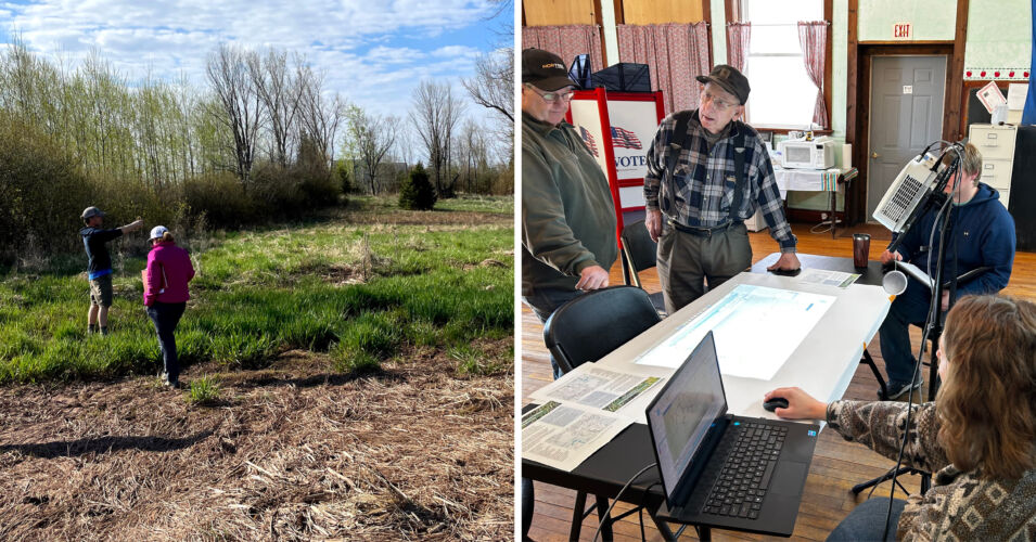
In December, WWA, SRWA, and the Burke Center held the first one-on-one community conversation with the Town of Kelly. We used an interactive map to help view and discuss priority sites where the town experiences road infrastructure, flooding, and erosion-related challenges, and to begin examining where wetland storage or floodplain functions may be compromised upstream of those sites.
In the coming wintry months, we will continue developing watershed data and hosting many more one-on-one conversations with towns and tribes. Until next time!
Top photo: Kyle Magyera presenting at GLIFWC’s nibi workshop.
Related content
$1.45 million awarded in highly competitive grant
What we’ve been up to with the NOAA Flood Resilience Project
Our legacy of wetland loss: Behind our water problems