This is the third in a series of four blog posts on hydrologic restoration in Wisconsin. Read part 1, “How wetlands manage water,” part 2, “Changes to our land, challenges for our waters,” and part 4, “Fixing our waters: Community-led watershed-based hydrologic restoration in Wisconsin”.
A fundamental principle of watershed science is that upper watershed wetlands and middle watershed floodplain areas provide critical storage of rain and snowmelt, slow the flow of water moving downstream, and retain sediment and nutrients. When we remove or damage those wetlands and floodplains or disconnect them from associated streams, we lose this storage, and runoff moves swiftly downstream, in turn producing elevated and flashy flood peaks. These degraded conditions exist across much of Wisconsin and contribute to many of the state’s most dangerous and expensive water management problems. Here’s how:
Flooding and infrastructure damage
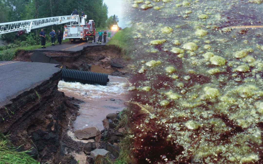
Flooding and infrastructure damage are the most obvious direct results of our actions that reduce the wetland storage of our upper and middle watersheds. The economic and social tolls are severe as high energy flood flows associated with intense, localized rain events overwhelm our roads and culverts. Rain events of historic scale now occur every year in communities all across Wisconsin (see right), and climate models predict they are here to stay.
Annual flood damages to public infrastructure in Wisconsin extend into the tens of millions of dollars. Post-flood restoration funds typically pay to return conditions to “normal” pre-flood conditions only to have this rebuilt infrastructure damaged again when the next historic rain event comes just a few years later. As conditions become more and more unraveled with each runoff event, we’re watching the resiliency of our watersheds disappear before our eyes. It is not sustainable to retain this amount of damage this frequently.
Wisconsin disaster declarations*
| DATE | DAMAGES | REGION |
| July 2016 | $35 million | North |
| July 2017 | $10 million | SC/SW |
| June 2018 | $13 million | North |
| Aug/Sep 2018 | $37 million | SC/SW |
| July 2019 | $19 million | SC/SW/C/NE |
*Damage to public facilities & infrastructure from excessive runoff.
Source: Wisconsin Emergency Management
Sediment deposition
Increased runoff from wetland loss and landscape alteration has been carrying soil and sediment from eroding streambanks and farm fields downstream for decades. Sediment deposition fills in wetlands, stream channels, and floodplains. It buries trout spawning gravels, degrades waterfowl habitat, eliminates wild rice beds, and alters the course of water movement. Areas that never seemed to flood before suddenly are inundated with water and sediment, leaving a muddy mess after each flood event.


Can you tell which river has a history of wetland loss? These photos were taken on the same day in adjacent watersheds. The river on the right is carrying more sediment than the one on the left, and it has also lost much of its upper watershed wetlands.
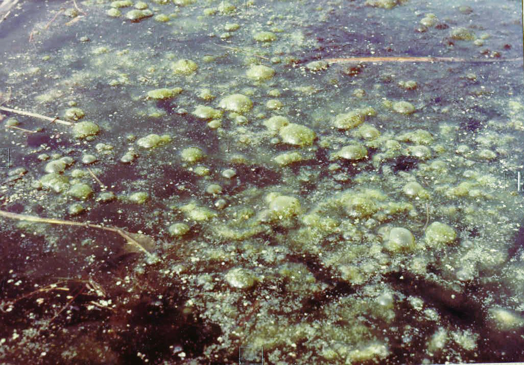
Dense algal blooms like this can result from eutrophication, which occurs when a body of water becomes overly enriched with minerals and nutrients. Eutrophication can also cause oxygen depletion of the water body, killing plant and animal life.
Nutrient transport
The same peak flood conditions that wash soil off of our farm fields and into our downstream lakes, rivers, and wetlands also transport nutrients into these waters. In healthy landscapes, upper watershed wetlands and connected floodplains are great at processing nutrients (especially nitrogen) and capturing phosphorus-laden sediment. In degraded watersheds, however, nutrients flushed into our waters cause algal blooms, promote the growth of invasive species that overwhelm fish and wildlife habitat, and contribute to a whole host of other problems. It’s no coincidence that maps showing Wisconsin’s wetland loss match up well with maps showing nutrient impaired lakes and waterways.
Changes in groundwater levels
While upstream alteration causes downstream challenges, impacts to groundwater from landscape alteration occur throughout the watershed. In upper watershed areas, wetland loss interrupts groundwater recharge. Erosion-induced gullies act like agricultural drains, not only removing water that might have soaked into the ground but also changing the movement of the groundwater towards and into the gully, transporting it downstream. Lower groundwater levels are the result, contributing to reduced spring activity, instream flow, and lake levels. Groundwater accessed by domestic and agricultural wells is harder to come by, vegetative communities change, trout suffer from the loss of baseflow, and wildlife habitat deteriorates.
In contrast, groundwater in downstream areas can experience over-saturation when water rushes from upper regions into flat, low-lying portions of the watershed. Basements flood, roads get inundated, wetland and estuary hydrology changes, invasive plants flourish, and cropland becomes unfarmable. When disturbance occurs in places where groundwater levels are already stressed by human use, these issues are compounded.
How do we fix all this?
Restoring healthy water flow to our landscapes across Wisconsin requires knowledge, support, partnerships, and coordinated effort at a landscape scale. Unfortunately, there are no recipe books for this type of work. Stay tuned for another blog post coming soon in which we’ll provide hope by looking at examples where communities are coming together to return health to their watersheds. We’ll explore the common elements of successful landscape-scale restoration and what’s needed to replicate local action at larger scales.
Related content

Developing a shared understanding of watershed-based hydrologic restoration

How wetlands manage water
Take a look at how wetlands work together in a watershed to manage water.

Changes to our land, challenges for our waters

Fixing the water: Community-led watershed-based hydrologic restoration in Wisconsin