Gilbert Fowler White (widely recognized as the father of floodplain management) argued in 1945 that human responses to control floods—such as levees, channel straightening, dredging, wetland drainage, and other structural interventions—actually increase flood damages. White was famous for reminding all who would listen that floods are acts of nature, while flood damages are acts of humans.
His message was provocative because it challenged the idea that flooding is inherently bad and elevated the importance of floodplains as essential elements of healthy river systems. The tension between these two perspectives persists today.
Despite White’s efforts, public understanding of how floodplains function and their roles in meeting ecological and societal needs remains remarkably low. We hope to help bridge these gaps with this primer on some basic features of healthy floodplains, setting the stage for more in-depth discussion in the future.
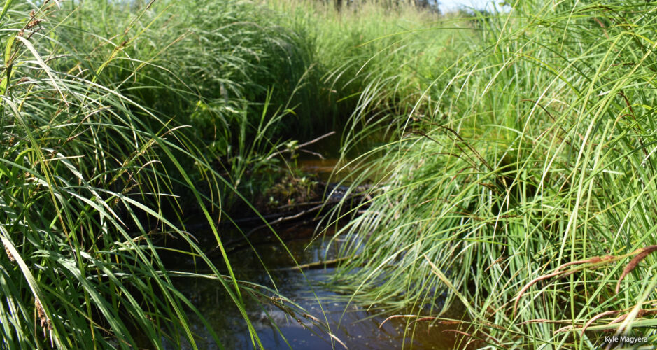
In this flat sedge meadow floodplain, floodwaters spread out so well that the water follows no single stream or path.
Floodplains are flat.
Floodplains are natural features on the landscape that form in flat areas adjacent to rivers and streams. Keeping in mind that a fundamental job of rivers is to move water, sediment, and debris, the job of a floodplain is to receive water, sediment, and debris during times of high flow.
In Wisconsin, rivers and streams typically flood in spring after snowmelt and during times of large rain events. During these runoff events, water moves across upland areas, picking up sediment and debris (trees, floating materials, etc.). The resulting slurry enters a river or stream channel and is swiftly transported downstream. Because they are flat, when waters rise, floodplains provide areas for water to spread out, slow down, and deposit all this material.

This mesmerizing map from the US Army Corps of Engineers (1944) shows the many historic channels of the Mississippi River—each color is a different path through which the river has flowed.
Floodplains are dynamic and complex.
In a healthy floodplain, the mix of sediment and material being picked up by the flowing water in one location balances out with the amount deposited in another section. This, in a nutshell, is why rivers, streams, and their floodplains are always changing.
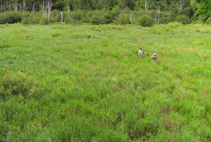
How a floodplain floods depends on many factors. Interactions between water, debris, vegetation, side channels, and floodplain landforms dictate how water moves out of the main channels and into the floodplain. Historically, many floodplain areas in Wisconsin were composed entirely of wetlands, especially grass and sedge meadows. Others contained mosaics of forests, side channels, wetlands, and lowlands often influenced by beavers. The dynamics of these variables created great diversity such that no two floodplains functioned completely alike. And no floodplain remained the same over time.
A good floodplain is a messy floodplain.
With floodplains, messy is good. Messy floodplains reduce the “flashiness” of flood flows, allowing water levels to rise slowly, peak at lower heights, and subside slowly, reducing the erosive energy of flood waters. This is accomplished by the friction or roughness associated with wetland vegetation, deposited debris, and landscape complexity. Thanks to friction, a messy floodplain performs much better than a clean floodplain.
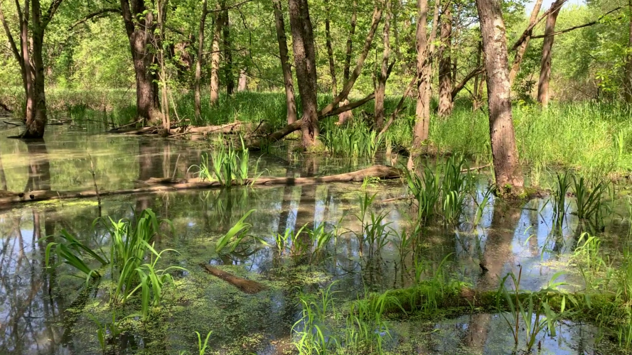
The backwaters of the Lower Wisconsin River are great examples of messy floodplains where no two steps will look the same.
What happens when we alter or lose floodplains?
Gilbert Fowler White was right; floodplains that flood are essential to the health of river systems and to our communities. We live in an altered landscape that no longer meets ecological or societal needs.
Our legacy of floodplain loss and disconnection is a major factor contributing to culvert and road damage, bank erosion, crop failure, impairment of groundwater quality and quantity, loss of biodiversity, reduction in base flow, habitat degradation, and countless other watershed-scale issues. Though many of our floodplain areas were lost decades ago, storm events today are increasing in size and frequency, and these problems are growing worse.
What can we do?
In Wisconsin, we must find ways to bring back the water-managing functions of floodplains. And there are no shortcuts. We cannot restore floodplain functions if the land does not flood. Strategic floodplain reconnection is needed across the state, but accomplishing this in a modern landscape involves many challenges. Addressing these challenges is a priority of Wisconsin Wetlands Association and will be the subject of discussion in future issues of our membership newsletter. Stay tuned!
Related content

From the Director: The un-gentle nature of disconnected floodplains

Wisconsin Towns Association Guest Column: Pre-Disaster Flood Resilience Bill
Wetland Coffee Break: Piloting natural flood management in the Lake Superior basin