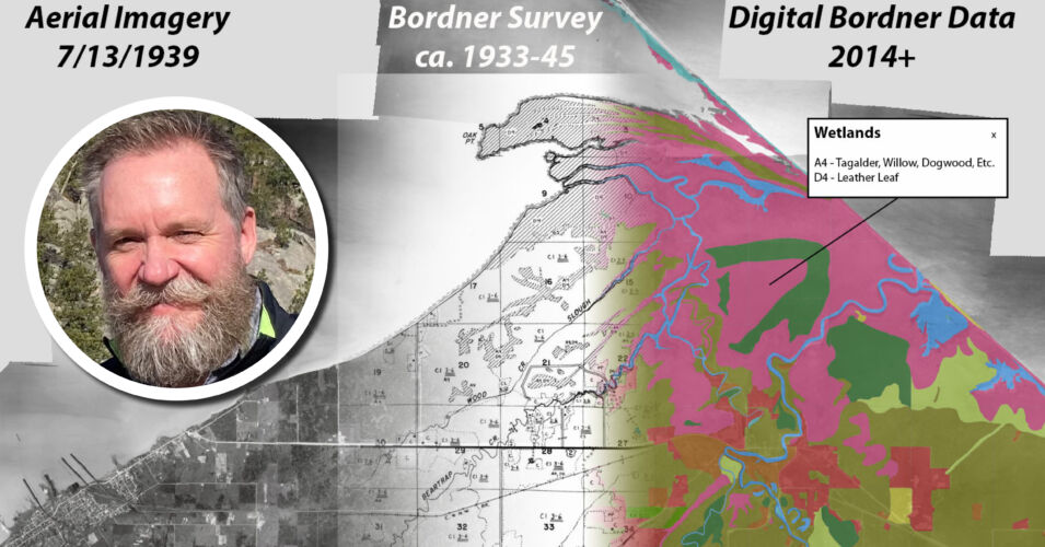
Whether you are interested in wetlands or other landscapes, historical geospatial data can be invaluable for understanding past conditions. But where can you get historical data in a format that is easy to use? Fortunately, there are a number of sources, including historic aerial photos, the Bordner Survey, US Geological Survey topographic maps, Public Land Survey records, and more. Join cartographer Howard Veregin to learn more about these sources and their main features.
Howard Veregin, Wisconsin State Cartographer
Recorded May 26, 2023
Howard Veregin was appointed State Cartographer in September 2009. His previous positions include Director of Geographic Information Services at Rand McNally, Associate Professor of Geography at the University of Minnesota-Twin Cities, and Assistant Professor of Geography at Kent State University. Howard received his Ph.D. from the University of California-Santa Barbara in 1991.
- SCO website: https://www.sco.
wisc.edu/ - Topoview: https://ngmdb.usgs.
gov/topoview/ - Topo map symbol sheet: https://www.usgs.gov/
faqs/where-can-i-find- topographic-map-symbol-sheet - GLO survey notes and maps: https://digicoll.
library.wisc.edu/SurveyNotes/ - Bordner scanned maps: https://search.library.
wisc.edu/digital/AWILandInv - Bordner digital data: https://maps.sco.wisc.
edu/BordnerCoastal/about/ - WGNHS: https://home.wgnhs.wisc.edu/
- Robinson Map Library: https://geography.
wisc.edu/maplibrary/ - Geodata@Wisconsin: https://
geodata.wisc.edu/ - AGS Library: https://uwm.edu/
libraries/agsl/ - Historical Society maps: https://www.
wisconsinhistory.org/Records/ Article/CS15301 - The slideshow on Slideshare: https://www.
slideshare.net/WisconsinSCO/ wwavereginmay2023pptx
Related Content


Get to know your wetland by creating a base map
