Springs are an awesome example of the concept of one water, the way we understand the connection between water in the ground and water on the surface as a single resource. Springs exist as the interface where groundwater becomes surface water.
To hydrogeologists, springs are interesting because they are an accessible window into the state of our groundwater. As surface water, springs are ecologically valuable, and help sustain Wisconsin’s renowned wetlands and trout streams. Many springs in Wisconsin tend to maintain a steady temperature throughout the year (hovering around 50°F). These stable environments can be spots of biodiversity and are habitats for endangered and threatened species. Because springs are so intrinsically connected to groundwater, however, they are also a threatened ecosystem—springs can be vulnerable to human activities that cause groundwater depletion or pollution.
In 2003, Wisconsin passed a law granting large springs some legal protections from groundwater pumping. Statute 281.34 mandates that impacts to large springs be considered when reviewing applications for high-capacity wells. Modern field data about springs is lacking across most of the state, though, and the number of high capacity wells in Wisconsin is rising. Now more than ten years after Statute 281.34 went into effect, we are working on finding, mapping, and describing large springs in the state. The inventory covers information on location, spring type, flow rate, water quality, environmental disturbance, geomorphology, and geology.
It’s a big task, for sure. When we’re finished, this inventory will be one of the only contemporary and comprehensive statewide spring datasets in the country.
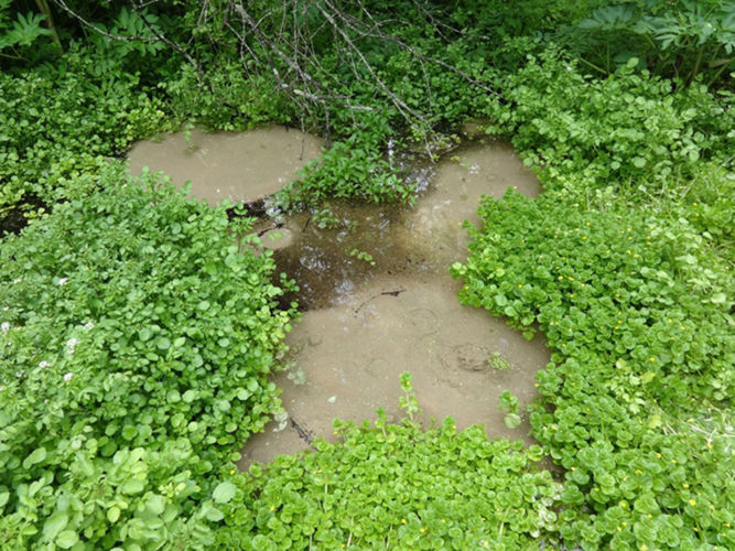
To date, my team and I have surveyed more than 380 springs in Wisconsin. We are finding a variety of kinds of springs, distributed across different geological regions of the state. Some springs seep out of the ground as flowing streams. Other springs flow directly out of exposed bedrock. Others bubble up through sand, resembling boiling porridge.
Because we can’t closely monitor all of the springs in the state, we’ve also chosen a few representative springs to revisit for sustained monitoring. By studying seasonal variations in flow, water quality, and temperature at these reference springs, we can tackle questions about groundwater flow systems. And we can draw basic conclusions about similar springs.
The statewide springs inventory will be an important step to understanding the vulnerability of different springs to groundwater withdrawal and changes in precipitation and groundwater recharge. Since all water is connected, this work has the potential of exposing the vulnerability of different water environments around the state (like wetlands connected to springs) to these same changes.
Photos and video by Grace Graham
Related Content

Wetlands and groundwater: It’s all connected

How will climate change affect groundwater and runoff into wetlands?

Wetland Coffee Break: Karst hydrogeology & wetlands