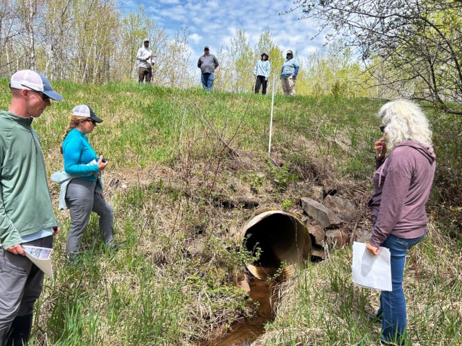
During the final week of October, Kyle Magyera and Stephanie Rockwood from Wisconsin Wetlands Association (WWA) teamed up with partners to host a workshop titled Slow the Flow – Reducing Flood Risks with Culvert & Upstream Solutions. Hosted in Washburn, Wisconsin, this event kicked off the second year of a NOAA-funded project in the Lake Superior Basin.
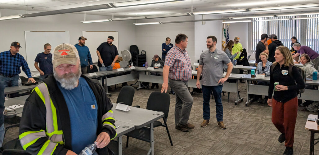
The main goal of this workshop was to gather communities from the region to discuss culvert and road management challenges related to flash flooding and excess erosion, and they might reduce risks by addressing the wetlands and floodplains upstream. Workshop attendees joining us were road managers, town chairs, and staff from 13 towns and tribes across the Fish Creek and White River Watersheds and the Bayfield Peninsula. Also in attendance were project partners representing Ashland and Bayfield County Highway and Land and Water Conservation Departments, Lake Superior Collaborative, Trout Unlimited, Wisconsin Towns Association, Superior Rivers Watershed Association, and the Great Lakes Indian Fish and Wildlife Commission.
Kyle shared information on common root causes of culvert and road damages related to excess erosion, sediment, and debris, flashy flows, historic changes to the landscape, and the loss of wetland and floodplain connectivity. He was joined by Katti Renick from Trout Unlimited to discuss different assessment approaches and natural flood management solutions that can be easily used by small communities to improve infrastructure resilience.
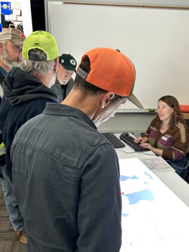
Town and county representatives gather around a tabletop mapping station being run by WWA’s Stephanie Rockwood.
Later on in the workshop, the focus shifted to a conversation on ways to increase local capacity to work upstream in wetlands and floodplains in tandem with regular maintenance and upgrades to road infrastructure. Partners and participants discussed how creative partnerships and strategies can open up new funding, help work with private landowners, plan and implement projects to upgrade and replace aging culverts, and work with nature — all slowing the flow and improving community resilience.
For example, when one town spoke about their continuous management needs in culverts where the beaver populations are healthy, other attendees shared their tools for success, including using beaver deceivers.
To wrap up the afternoon, attendees gathered around two tabletop mapping stations run by Stephanie Rockwood from WWA and Kevin Brewster from Superior Rivers Watershed Association. This interactive mapping exercise allowed community members to explore culvert vulnerability and landscape data and flag the locations of culvert and bridge crossings where towns are experiencing frequent issues.
These conversations will continue into the coming winter and spring under the NOAA-funded project as WWA and partners meet one-on-one with towns and tribes in the Lake Superior region.
Related content
$1.45 million awarded in highly competitive grant
What we’ve been up to with the NOAA Flood Resilience Project
Recapping “Resilient Streams, Resilient Infrastructure” joint session at the Wetland Science Conference