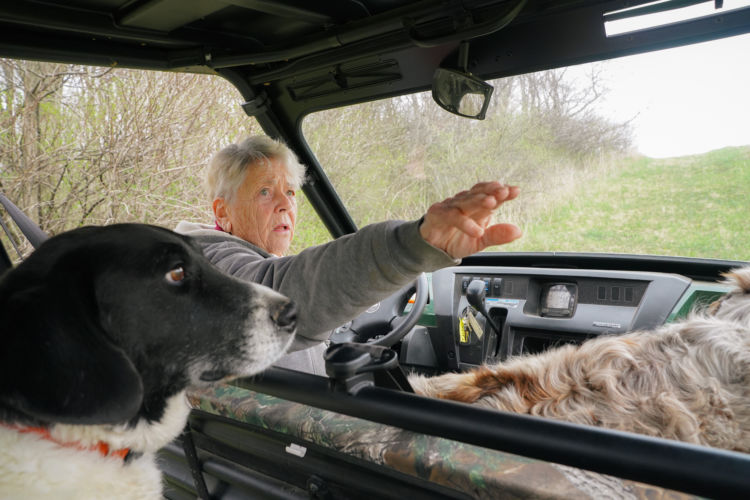
As a statewide organization, Wisconsin Wetlands Association (WWA) must make strategic decisions about where, when, and how we get involved in local on-the-ground projects. Our involvement in a project in the Fancy Creek watershed in the Driftless Area started when landowner Marilyn Houck (pictured here) reached out to us about her wetlands. Since Marilyn’s call, her neighbors and local agencies have joined the team working to develop and implement solutions for challenges in their watershed.
For years, Marilyn Houck and her late husband Kent would pass by the wetlands on their land and wonder what they could be doing to care for them.
Marilyn owns farmland near Richland Center along Fancy Creek, a tributary of the nearby Pine River. Back in the early 20th century, people began ditching the creek to drain the adjacent land for farming. Today, because of this ditching, water from the stream doesn’t interact with the floodplain anymore. Instead, when big rains and floods come, water laden with sediments and nutrients races through the ditch like a fire hose.
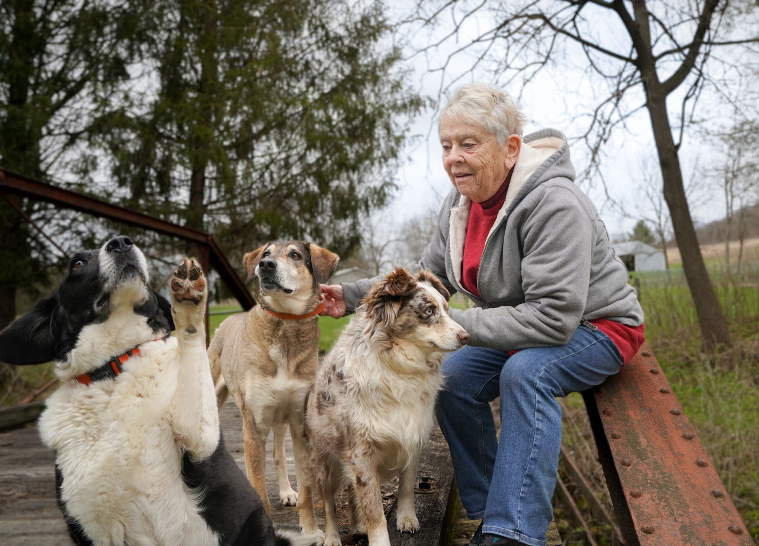
Marilyn Houck, pictured here with her dogs (from left to right), Mr. Peabody, Wally, and Lena, has always been curious about the wetlands on her property, but didn’t know how to improve them. Photo by Emily Buck.
On Marilyn’s property, the historic channel is still visible in some places (even more so in aerial images), and the floodplain in these areas is filled with sedges and other beautiful wetland vegetation. But Marilyn didn’t know how to care for these wetlands or how to make them healthier. One day, she was listening to the “Larry Meiller Show” on Wisconsin Public Radio’s Ideas Network when she heard two women talking about wetlands. Those women were Wisconsin Wetlands Association (WWA) staff Katie Beilfuss and Erin O’Brien.
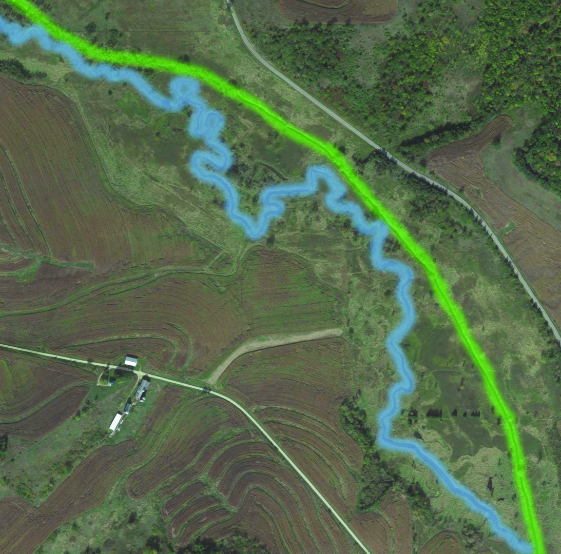
In this satellite view, you can see the linear ditch (highlighted in green) that follows the road on the right, as well as the winding original channel (highlighted in blue).
So, Marilyn gave WWA a call and asked us for some advice. When WWA Executive Director Tracy Hames saw her property, he immediately saw the potential for watershed-scale hydrologic restoration. The historic floodplains are still intact and the stream just needed to be redirected to the historic natural channel. The project definitely would require some hard work and investment, but the critical features were there.
Since that first phone call, the project has grown to include multiple state and local agencies—and the project area has grown too. With Marilyn’s help, WWA and Robert Pearson of the Wisconsin Department of Transportation have met with Marilyn’s neighbors about the project to hear their concerns and explore possibilities for addressing them. These neighbors now want to be involved to improve the health of their land and watershed.
This is how our place-based projects grow. They start with a seed—like the initiative and curiosity of Marilyn and her late husband—and grow as more neighbors see what’s going on, like it, and want their land to be part of it.
As the project area continues to grow and the partners develop plans, Marilyn is looking at how to protect the health of her property into the future. Working with Mississippi Valley Conservancy, Marilyn is putting a conservation easement on the floodplain and much of her property—including considerations for long-term management—so that the restoration work being planned will be protected for generations to come.
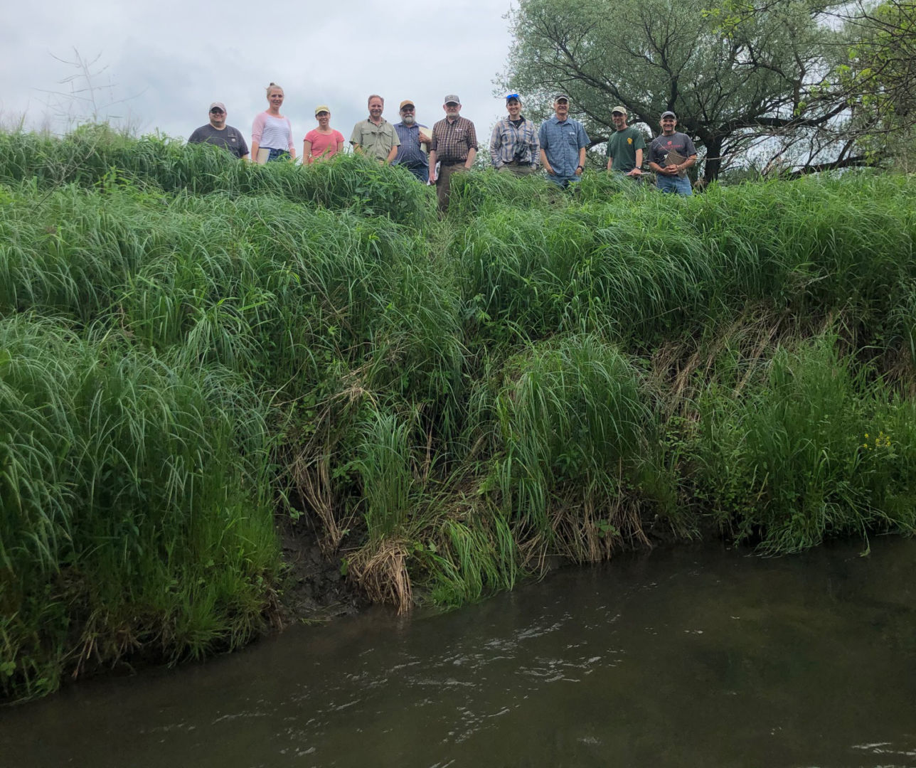
As you can see in the photo of project team members, the banks of the ditch on Marilyn’s property are very high, making it difficult for water to interact with the floodplain. Instead, high water rushes downstream, further eroding the channel. Photo by Cory Ritterbusch.
WWA gets calls from many curious landowners and concerned community members about wetlands. Since we are a small staff, we can’t visit each one in person or facilitate a restoration project. So why did we get involved in this project? Why this property?
The ditching at Marilyn’s property is common throughout the Driftless area and so are the associated flooding and infrastructure issues. Policymakers and landowners in the Driftless area are looking for ways to slow the flow of water and reduce flood damages. By demonstrating cost-effective ways to reconnect the floodplains on Marilyn’s property, we can have a wider impact on how people approach wetland and wetland restoration throughout the Driftless Area.
Marilyn’s property is also a catalyst for action because she is a fixture in her community, beloved by many. A comment we hear time and again from partners and neighbors: “We’re doing this for Marilyn. And the dogs.” We are fortunate that she was listening to the radio that day and gave us a call—and so is her watershed.
Related content


Private landowners play a vital role in caring for wetlands

